Picture Canyon Natural and Cultural Preserve
Picture Canyon Natural and Cultural Preserve is a 30-acre archaeological site and nature preserve located in northeast Flagstaff, Arizona, featuring Sinagua petroglyphs, seasonal waterfalls, and three scenic trails.
This hidden gem offers a unique blend of outdoor recreation and cultural history, allowing visitors to explore ancient petroglyphs while enjoying easy-to-moderate hikes with views of waterfalls and riparian habitat—all within city limits.
From downtown Flagstaff, head north on N Fort Valley Road, turn left onto N El Paso Flagstaff Road, and look for the preserve entrance at 3920 N El Paso Flagstaff Rd. Signage and a small parking area are available.
Know Before You Go
- 📵 Cell service: Expect limited or no signal. Download offline maps before you leave the trailhead.
- 🗺️ Access varies seasonally: Trail and road conditions shift with weather and snow. Verify current status with the local ranger district before you go.
- ⚠️ Conditions are not monitored live: Confirm roads, permits, weather, fire restrictions, property boundaries, and closures with the official land manager before traveling. Use the article's Sources section when available; some legacy citations are still being upgraded.
- 📅 Published: May 2026. This is the editorial publication date, not a current-condition check.
Packing Checklist
- ☐ Sturdy hiking boots or trail shoes
- ☐ 1-2L water (no refill sources)
- ☐ Trail snacks / energy bars
- ☐ Sun protection (hat, sunscreen)
- ☐ First aid kit basics
- ☐ Map or downloaded trail (no cell service expected)
- ☐ Layers — mountain weather changes fast
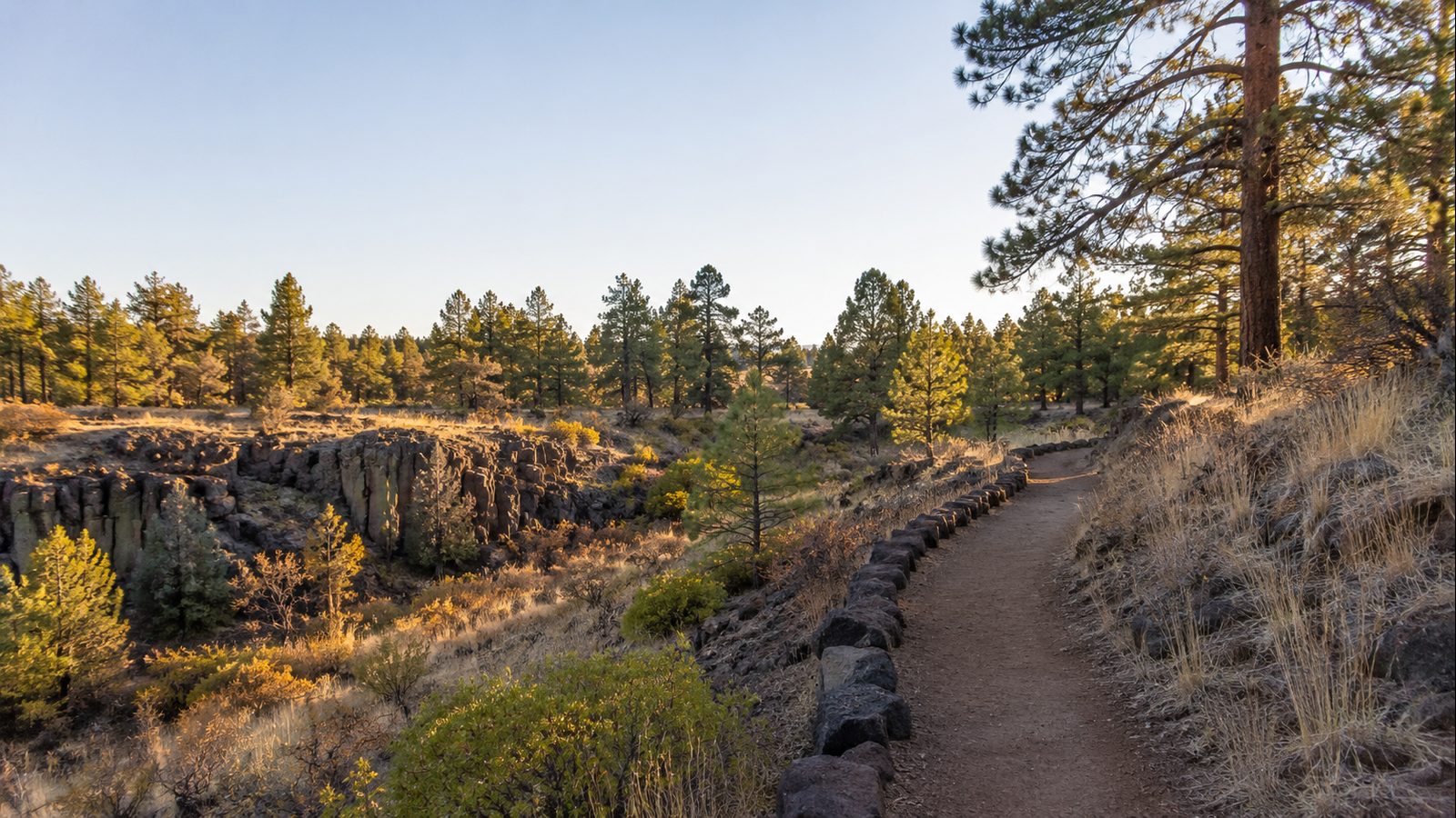
Picture Canyon Natural and Cultural Preserve sits in northeast Flagstaff, a five-minute drive from downtown that feels worlds away. The 478-acre preserve was purchased by the City of Flagstaff in 2012 for $4.8 million after decades of community advocacy, and it’s now a year-round public space that few tourists know exists.
Three trails thread through the preserve. The Tom Moody Trail covers a 2.8-mile outer loop along the canyon walls, crossing the Rio de Flag bridge and passing a seasonal waterfall that flows strongest after rains or snowmelt. The Don Weaver Trail cuts a 0.7-mile connector for a shorter loop with a different angle on the waterfall. And the Arizona Trail—part of the 800+ mile Mexico-to-Utah route—bisects the preserve for a 1.5-mile section. An outdoor classroom near the Tom Moody trailhead has educational panels on ecology and archaeology.
The real draw is the petroglyphs. Hundreds of Sinagua panels line the river canyon, carved between 700 and 1300 AD, depicting archers, geometric shapes, birds, turtles, and other local wildlife. The name “Picture Canyon” comes directly from this density of rock art. Reclaimed water from the adjacent Wildcat Hill Wastewater Treatment Plant feeds the Rio de Flag, keeping the riparian corridor alive even during dry months.
Verified Facts
- Listed on the National Register of Historic Places (January 10, 2008). Source: Wikipedia / NRHP
- Contains hundreds of Sinagua petroglyph panels along the Rio de Flag canyon walls. Source: Wikipedia
- Three named trails: Tom Moody (2.8 mi loop), Don Weaver (0.7 mi connector), Arizona Trail (1.5 mi section). Source: City of Flagstaff official page
- Purchased by City of Flagstaff October 30, 2012 for $4.8 million. Source: Wikipedia
- Year-round access with reclaimed water maintaining riparian habitat. Source: City of Flagstaff
Actionable Takeaways
- Visit the outdoor classroom near the Tom Moody Trail start for educational panels on ecology and archaeology.
- Check for recent rain or snowmelt to see the seasonal waterfall at full flow.
- Stay on marked trails and do not touch petroglyphs—this is an active archaeological site.
Open Questions / Caveats
- Cell service can be spotty within the canyon; download offline maps beforehand.
- Summer temperatures exceed 90°F routinely; bring extra water and hike early.
- Seasonal closures for maintenance are possible—check flagstaff.az.gov before visiting.