Babylon Arch Trail — Red Cliffs Desert Reserve
Babylon Arch Trail is a 1.5–2.2 mile family-friendly hike in the remote Babylon area of Red Cliffs Desert Reserve, leading to a near-perfect circular sandstone arch — roughly 8 feet tall and 10 feet wide — carved clean through a massive rock formation.
While Zion draws millions, this stretch of the Red Cliffs Desert Reserve sees a fraction of the traffic. The arch itself is a geological oddity — an almost mathematically round hole punched through desert sandstone — and the trail delivers red rock formations, Virgin River overlooks, and the kind of solitude you won't find at Angels Landing. The sandhill descent to the arch is a kid-approved highlight.
From St George, take I-15 north to Exit 23 (Leeds). Turn right onto Silver Reef Road and continue to the Sand Cove Trailhead (paved access, no 4WD needed). From there, hike ~0.75 miles along the bumpy 4WD road to the primitive camping area where the official Babylon Arch trail begins. If you have high-clearance 4WD, you can drive directly to the primitive camping area trailhead at coordinates 37.206290, -113.329849.
Know Before You Go
- 📵 Cell service: Expect limited or no signal. Download offline maps before you leave the trailhead.
- 🗺️ Access varies seasonally: Trail and road conditions shift with weather and snow. Verify current status with the local ranger district before you go.
- ⚠️ Conditions are not monitored live: Confirm roads, permits, weather, fire restrictions, property boundaries, and closures with the official land manager before traveling. Use the article's Sources section when available; some legacy citations are still being upgraded.
- 📅 Published: May 2026. This is the editorial publication date, not a current-condition check.
Packing Checklist
- ☐ Sturdy hiking boots or trail shoes
- ☐ 1-2L water (no refill sources)
- ☐ Trail snacks / energy bars
- ☐ Sun protection (hat, sunscreen)
- ☐ First aid kit basics
- ☐ Map or downloaded trail (no cell service expected)
- ☐ Layers — mountain weather changes fast
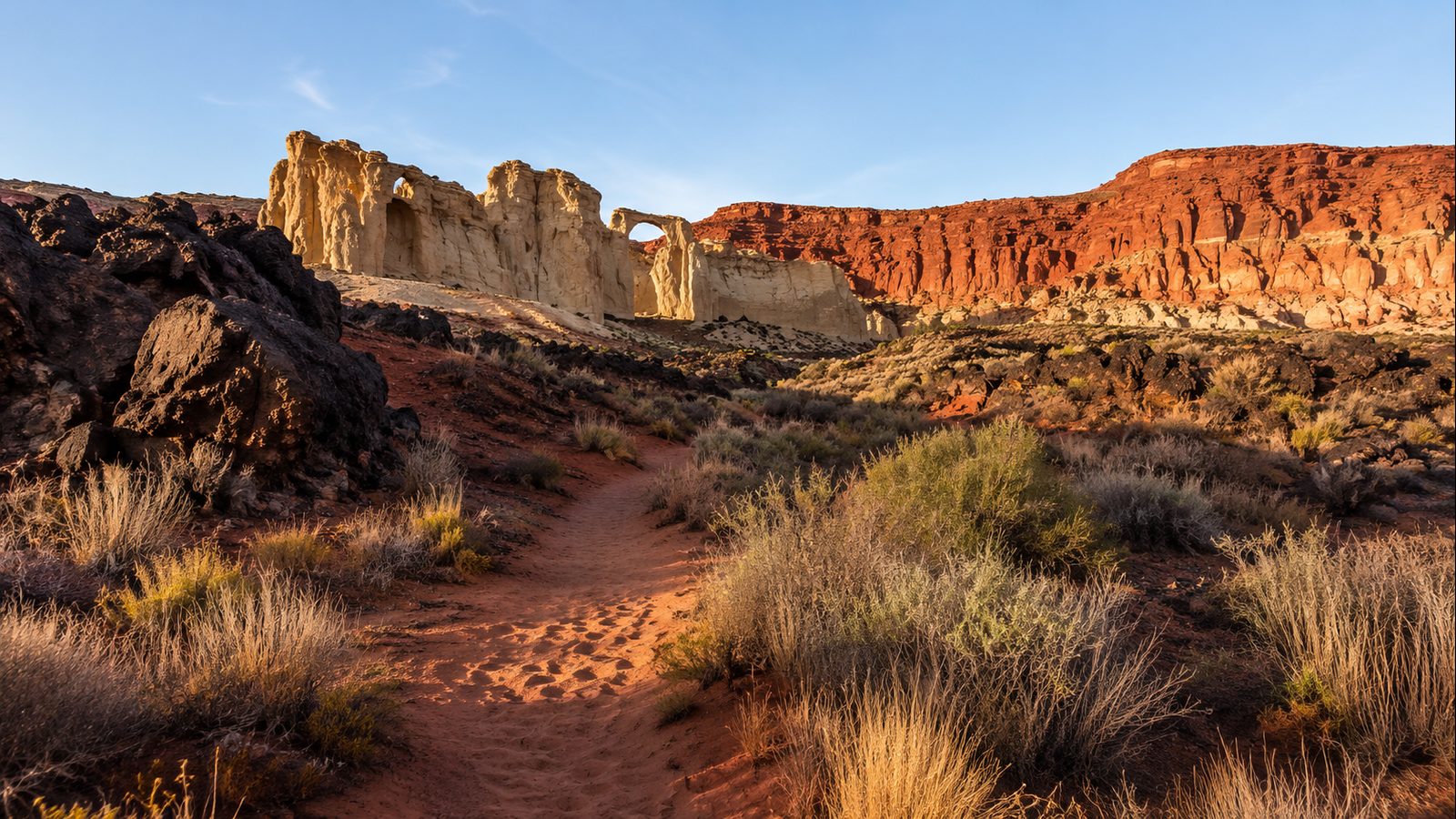
The first time you see Babylon Arch, you’ll wonder how a hole that perfectly round ended up in the middle of nowhere. The arch sits at the base of a steep sandhill in the Babylon area of Red Cliffs Desert Reserve, about a 33-minute drive from St George past the old silver mining town of Leeds. The approach is half the appeal: a sandy, rock-studded trail winds through classic southern Utah red-rock formations, then drops you down a surprisingly fun sandhill — kids sprint down it, adults slide on their heels — straight to the arch itself.
The arch opening is roughly 8 feet tall and 10 feet across, nearly circular, framing open desert sky and, if you keep walking, a view down to the Virgin River. The geology here is classic Red Cliffs: Navajo Sandstone carved by wind and water over millions of years, with iron oxide staining the rock in bands of red, orange, and cream. Unlike the Instagram-famous arches in Arches National Park, this one requires a bit of effort to reach and rewards you with genuine solitude — on a weekday morning, you’re more likely to share the trail with a jackrabbit than another hiker.
From the arch, a short spur trail leads down to the Virgin River, where you can dip your feet or filter water if you’re prepared. The primitive camping area near the trailhead is BLM-managed and free (permit required), making this an easy overnight option for stargazing — the dark-sky quality here is excellent, with the nearest town lights 15+ miles away. Just don’t come mid-summer midday: there isn’t a single patch of shade on the entire route, and the sand reflects heat like a skillet.
Verified Facts
- Trail length: 1.5 miles round trip from primitive camping trailhead; 2.2 miles from Sand Cove trailhead
- Arch GPS: 37°12’09.0”N, 113°20’05.7”W (confirmed via VisitUtah.com, Zion Adventure Photog)
- Managed by: BLM / Red Cliffs Desert Reserve — no day-use fee, no permit required for hiking
- Trail conditions: Dirt single-track, deep sand in sections, rocky/uneven, full sun exposure
- Best season: October through April; summer hiking requires pre-dawn start
- Facilities: None — no bathrooms, no water. Primitive camping available by permit at trailhead.
- Dogs allowed on 6-foot leash; horses permitted; no bikes or motorized vehicles
- Trailhead access: Sand Cove Trailhead is paved-accessible; primitive camping trailhead requires high-clearance 4WD
Actionable Takeaways
- Arrive before 8am on weekends — the small primitive camping lot fills by 9am in peak season
- Download offline maps before you go — cell service is unreliable throughout the Babylon area
- Bring 3L+ water per person and electrolyte tabs — there is no water on trail and the Virgin River requires purification
- Check flash-flood forecasts if rain is predicted; sandy washes can become impassable quickly
- Combine with a dip in the Virgin River (trail fork past the arch) if water levels permit
- Visit between October–April for comfortable temperatures; if visiting May–September, start at sunrise and be back by 10am
Open Questions / Caveats
- Trail markers are sparse — the path forks in places and is easy to lose; GPS coordinates for the arch are essential backup
- After heavy rain, sandy sections become heavy slogging and the access road may be impassable
- Photography tip: the arch photographs best in late afternoon when light pours through the opening, but you’ll be hiking back in fading light — bring the headlamp
- Flash flooding risk in the Virgin River drainage during monsoon season (July–September)
- Verification note: details confirmed via web crawl of VisitUtah.com, Zion Adventure Photog, and HikeStGeorge.com — not on-the-ground verified
Sources
- https://www.redcliffsdesertreserve.com/babylon-area
- https://www.visitutah.com/places-to-go/parks-outdoors/red-cliffs-national-conservation-area/red-cliffs-and-babylon-eastern-areas
- https://www.zionadventurephotog.com/single-post/hiking-babylon-arch-red-cliffs-reserve
- https://hikestgeorge.com/hiking-trails/babylon-arch-red-cliffs-desert-reserve/